We built Routely in Columbus partly because this is where we were, and partly because this city is genuinely the best place in the country to build and test regional delivery logistics software. That's not civic boosterism — it's a structural argument about what makes a good proving ground for operations tools, and Columbus scores better on almost every relevant dimension than markets with more obvious tech scenes.
If you want to understand why regional carrier operations software gets built and tested here, you have to understand the geography, the industry mix, and what the delivery problem actually looks like in central Ohio.
The geographic argument: a lab in a hub
Columbus sits at the junction of I-70 (east-west across the continental US) and I-71 (northeast to Cleveland and Cincinnati). I-270, the outer belt, wraps the metro and connects every industrial zone to every residential zone in a roughly 50-mile loop. Within that ring, you have the full spectrum of delivery geography: dense urban cores (Short North, downtown), medium-density suburban rings (Westerville, Gahanna, Grove City), and low-density exurban areas (Pickerington, Canal Winchester, Hilliard) — all within a 35-minute drive of each other.
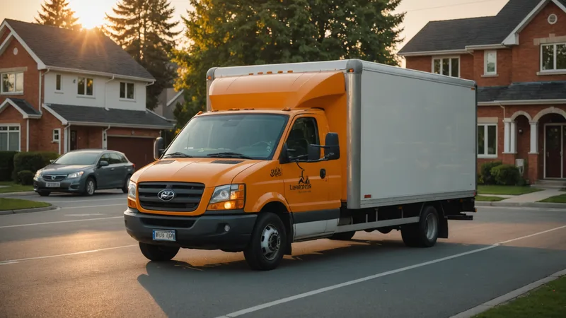
That geographic variety matters enormously when you're trying to build routing software that works for regional carriers. A tool that performs well in a dense urban core but degrades in suburban stops-per-mile conditions hasn't been properly tested. Columbus forces you to handle both in the same route, sometimes in the same morning run. A carrier picking up at the Columbus produce terminal on Cleveland Avenue and delivering to restaurants in the Short North, then continuing out to institutional accounts in New Albany, is dealing with four different density regimes in a single driver manifest.
Within a 10-hour drive, Columbus puts you in reach of roughly 60% of the US population. That number is real — it's one of the reasons national distribution centers cluster here. But for regional carriers, the more relevant fact is that Columbus is a representative mid-size American metro: big enough to have traffic complexity and diverse delivery verticals, small enough that a fleet of 20-30 vehicles can cover it meaningfully in a day.
The industry mix: every delivery vertical in one market
Central Ohio has a concentration of delivery verticals that is almost implausibly varied for a single mid-size metro. Food service distribution (the I-71 corridor north of downtown is heavy with distributors feeding Columbus's restaurant density), building materials (the construction activity along the outer ring has been consistent for a decade), healthcare supply (the Ohio State medical complex alone is a substantial delivery destination), and light manufacturing supply chains running out to the Honda supply chain in Marysville and Circleville.
What this means for routing software is that you get to test against genuinely different delivery constraint profiles in the same market. A food service stop has tight time windows, temperature considerations, and dock scheduling. A construction supply stop has job-site access variables and material handling requirements. A healthcare stop has specific receiving procedures. Building software that handles these well means your constraint model has to be flexible enough to accommodate fundamentally different stop types — not just "residential versus commercial."
We've worked with carriers here who handle all three verticals in a single fleet, routing food service runs in the early morning and building supply runs in the mid-morning with the same vehicles and drivers. That's operationally complex in ways that a single-vertical carrier in a simpler market doesn't surface. It's exactly the complexity that makes the routing problem interesting and the solution more durable when you take it elsewhere.
The regional carrier ecosystem: what's actually here
Beyond the big names — the national carriers with facilities off I-70 and I-71 — Columbus has a surprisingly dense ecosystem of regional and local carriers operating in the 10-to-60-vehicle range. Grocery distributors, specialty food carriers, medical supply companies, restaurant equipment suppliers, industrial parts carriers. Most of them have been operating in central Ohio for 15 to 30 years and have deep relationships with their customer bases.
These are the fleets that national delivery platforms and enterprise TMS vendors haven't prioritized. They're too small for enterprise software contracts and too operationally complex for consumer logistics apps designed around residential parcel delivery. The operations manager is often also doing dispatch. The "routing software" is often a combination of a consumer navigation app, a spreadsheet, and institutional knowledge in the dispatcher's head.
Building for this segment in Columbus means we're constantly close to actual operators who will tell us immediately when something doesn't work for their specific route structure. That feedback loop is faster and more grounded than it would be in a market dominated by enterprise logistics operations.
What Columbus traffic patterns teach you about dynamic routing
Columbus has a specific traffic character that's worth understanding if you're building routing software here. The I-270 outer belt has congestion patterns that differ significantly by quadrant and time of day. Morning traffic toward downtown from the northwest (Dublin, Powell, Dublin Road corridor) tends to back up earlier and more severely than morning traffic from the southeast. The I-70/I-71 split downtown is consistently a problem spot in the 7:30-9 AM window. State Route 315 north from downtown to the Worthington area compresses predictably during school year mornings.
What this teaches you is that historical traffic patterns and live traffic patterns diverge meaningfully during non-standard events — a game at Ohio Stadium on a Saturday, a construction closure that diverts I-70 trucks onto 40, a weather event that turns the I-270 / SR-161 interchange into a parking lot. Routing software that relies only on historical patterns fails these scenarios. Building against Columbus traffic data over time forces you to get the live traffic weighting right, because Columbus produces those scenarios regularly enough that you can't ignore them.
A note on what Columbus isn't
Columbus is not a substitute for testing in markets with fundamentally different last-mile economics. Dense urban delivery in a market like Chicago or New York — where on-foot and bike delivery are significant, where parking and truck access are severe operational constraints, where stop density per square mile is an order of magnitude higher — involves a different set of problems than what Columbus surfaces. Our routing model is built for regional carrier operations in mid-density American markets, and that's where it performs.
We're not claiming Columbus solves the whole logistics software problem. We're saying it's the right place to solve the regional carrier problem — which is, frankly, underserved relative to its size. There are thousands of carriers operating 15 to 50 vehicles in mid-size American metros, spending significant dispatcher hours managing route quality by hand, with no good software fit. Columbus is where we can build and test for that segment better than almost anywhere else.
What the next few years look like from here
The logistics infrastructure around Columbus keeps growing. The Intel semiconductor manufacturing campus in New Albany, the continued expansion of distribution facilities along I-270 north and east, the healthcare system expansion around the Ohio State and Nationwide Children's campuses — all of it creates more delivery demand, more route complexity, and more need for carriers who can execute reliably in this market.
For the regional carriers we work with here, the question isn't whether the market will grow — it will. The question is whether their operations infrastructure can scale with the complexity. That's the problem Routely is built to solve, and building it here, against this market, with these carriers, is the right way to make sure we're solving it correctly.